
Recently when using the globe feature of Google Maps, I noticed something that seemed wrong to me.
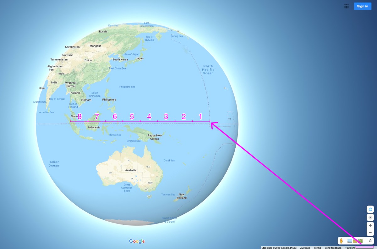
In globe mode, the map window displays a 2D Scale bar. As far as I can work out, a 2D scale bar on a 3D globe is never going to give an accurate measurement of distances between two points. Ironically Google Maps has an accurate measure tool built in to it that helps make it easy to demonstrate this.
Seems like a pretty small, but clear error.
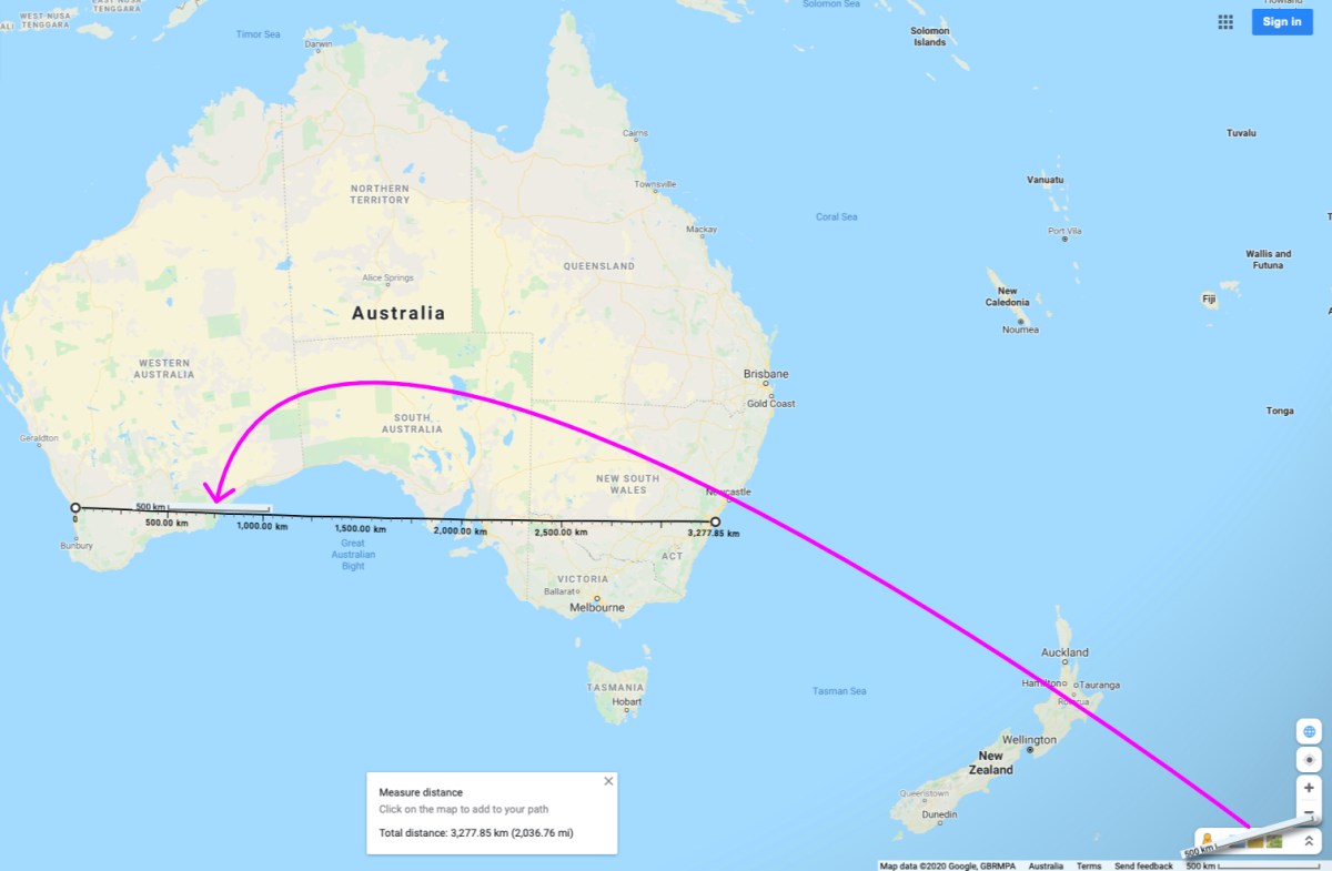
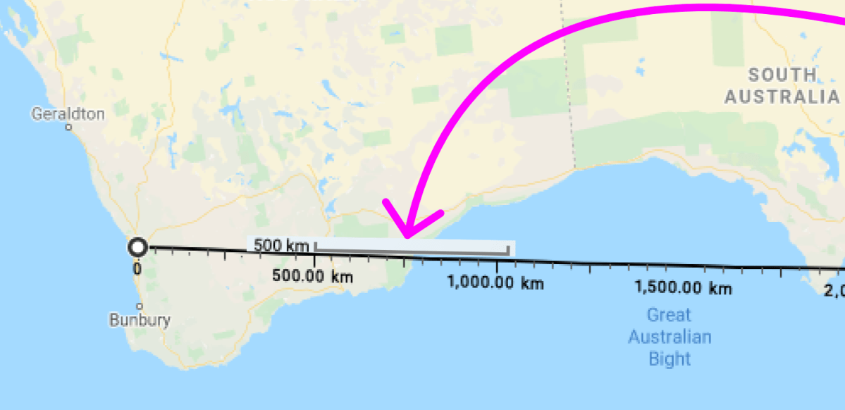
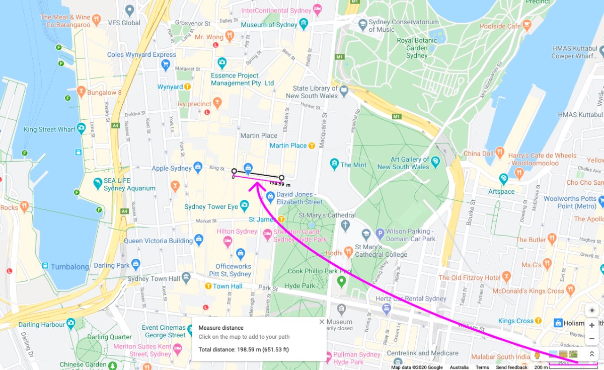
The problem is more pronounced the further you zoom out. Comparing two examples at very different zoom levels helps demonstrate this more clearly.
King Street between Pitt and Elizabeth Streets in Sydney, Australia is pretty close to 200m as the scale bar suggests.
Singapore to the 180 meridian is about 8464km.

But if we were to try measure that using the scale bar, we get closer to 7750km.
Thinking about this a little more, I realised the way Google Maps uses a scale bar in its 2D version has problems too.
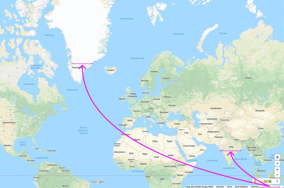
The distance between those two points in India is actually approximately 1,900km. The distance between those two points in Greenland is actually approximately 700km. So on the 2D map as well, the scale bar isn’t giving accurate absolute or relative distance measurements across the whole map.
I don’t imagine many (anyone?) would actually try use the scale bar to make measurements and that pointing this out might be an exercise in pedantry. But if it can’t give a correct measurement, and no one is going to use it, for me it just reinforces the question: why not just remove it?
